
Bali is the name of a province in Indonesia and also the name of the largest islands that are part of the province. In addition consists of the island of Bali, Bali province consists of the islands smaller in the vicinity, namely the island of Nusa Penida, Nusa Lembongan Island, Nusa Island and Island Ceningan attack.
Bali lies between Java and Lombok Island. Denpasar is the capital of his province, located in the south of the island. The majority of Balinese are Hindu. In the world famous Bali as a tourist destination with a unique variety of art-culture, especially for the Japanese and Australian tourists. Bali is also known as Island of the Gods and Pulau Seribu Pura.
Bali lies between Java and Lombok Island. Denpasar is the capital of his province, located in the south of the island. The majority of Balinese are Hindu. In the world famous Bali as a tourist destination with a unique variety of art-culture, especially for the Japanese and Australian tourists. Bali is also known as Island of the Gods and Pulau Seribu Pura.
Geografi
Bali Island is part of the Lesser Sunda Islands along the 153 km and 112 km wide approximately 3.2 km from the island of Java. Astronomically, Bali is located at 8 ° 25'23 "south latitude and 115 ° 14'55" East Longitude tropical climate that makes it like other parts of Indonesia.
Gunung Agung is the highest point in Bali as high as 3148 m. The volcano last erupted in March 1963. Mount Batur is also one of the mountain in Bali. About 30,000 years ago, Mount Batur erupted and produced a terrible disaster on earth. Unlike in the north, the southern part of Bali is irrigated lowland rivers.
Based on the relief and topography, in the middle of the island of Bali lies the mountains that extends from west to east and between the mountains there are clusters of volcanic Mount Batur and Mount Agung and the mountains are not volcanoes, namely Gunung Merbuk, Gunung Patas and Mount Seraya. The existence of these mountains cause by Geographic Area Bali is divided into 2 (two) parts that are not the same, namely North Bali with a narrow lowland and less sloping and the South of Bali with a broad lowland and sloping. Bali slope consists of flat land (0-2%) covering 122,652 hectares, undulating land (2-15%) covering 118,339 ha, steep land (15-40%) and land area of 190,486 ha of very steep (> 40%) an area of 132,189 ha. Province of Bali has 4 (four) lakes located in mountainous areas, namely Danau Beratan, Buyan, Tamblingan and Lake Batur.
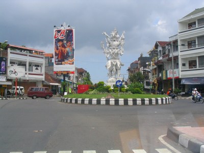
The capital of Bali is Denpasar. Places Ubud Other important as the art center is located in Gianyar regency, while Kuta, Sanur, Seminyak, Jimbaran and Nusa Dua are some places that a tourist destination, both tourist and beach resorts.
The total area of Bali Province is 5636.66 km2 or 0.29% of the territory of the Republic of Indonesia. Administratively, the Province of Bali is divided into 9 districts, 55 districts and 701 villages.
Gunung Agung is the highest point in Bali as high as 3148 m. The volcano last erupted in March 1963. Mount Batur is also one of the mountain in Bali. About 30,000 years ago, Mount Batur erupted and produced a terrible disaster on earth. Unlike in the north, the southern part of Bali is irrigated lowland rivers.
Based on the relief and topography, in the middle of the island of Bali lies the mountains that extends from west to east and between the mountains there are clusters of volcanic Mount Batur and Mount Agung and the mountains are not volcanoes, namely Gunung Merbuk, Gunung Patas and Mount Seraya. The existence of these mountains cause by Geographic Area Bali is divided into 2 (two) parts that are not the same, namely North Bali with a narrow lowland and less sloping and the South of Bali with a broad lowland and sloping. Bali slope consists of flat land (0-2%) covering 122,652 hectares, undulating land (2-15%) covering 118,339 ha, steep land (15-40%) and land area of 190,486 ha of very steep (> 40%) an area of 132,189 ha. Province of Bali has 4 (four) lakes located in mountainous areas, namely Danau Beratan, Buyan, Tamblingan and Lake Batur.
The capital of Bali is Denpasar. Places Ubud Other important as the art center is located in Gianyar regency, while Kuta, Sanur, Seminyak, Jimbaran and Nusa Dua are some places that a tourist destination, both tourist and beach resorts.
The total area of Bali Province is 5636.66 km2 or 0.29% of the territory of the Republic of Indonesia. Administratively, the Province of Bali is divided into 9 districts, 55 districts and 701 villages.
History
 |
| The first inhabitants of the island of Bali 3000-2500 BC |
The first inhabitants of the island of Bali is expected to come in 3000-2500 BCE who migrated from Asia. [3] Remains of stone tools from this period are found in the village Cekik located in the western part of the island. [4] Age of prehistory and ending with the arrival of Hinduism and Sanskrit writings of India in 100 BC. [citation needed]
Culture of Bali later gained strong influence of Indian culture that the process is more rapid after the 1st century AD. Name Balidwipa (Bali Island) began to be found in various inscriptions, including inscriptions Blanjong issued by Sri Kesari Warmadewa in 913 AD and mentions the word Walidwipa. It is estimated that around this time that Subak irrigation system for rice cultivation began to be developed. Some religious and cultural traditions also began to develop at that time. Kingdom of Majapahit (1293-1500 AD) who are Hindus and centered on the island of Java, had established the kingdom of subordinates in Bali around the year 1343 AD It was almost all over the country are Hindus, but as the arrival of Islam stood Islamic kingdoms in the archipelago, among others, led to the collapse of Majapahit. Many nobles, priests, artists and other Hindu community when it withdrew from the island of Java to Bali.
Culture of Bali later gained strong influence of Indian culture that the process is more rapid after the 1st century AD. Name Balidwipa (Bali Island) began to be found in various inscriptions, including inscriptions Blanjong issued by Sri Kesari Warmadewa in 913 AD and mentions the word Walidwipa. It is estimated that around this time that Subak irrigation system for rice cultivation began to be developed. Some religious and cultural traditions also began to develop at that time. Kingdom of Majapahit (1293-1500 AD) who are Hindus and centered on the island of Java, had established the kingdom of subordinates in Bali around the year 1343 AD It was almost all over the country are Hindus, but as the arrival of Islam stood Islamic kingdoms in the archipelago, among others, led to the collapse of Majapahit. Many nobles, priests, artists and other Hindu community when it withdrew from the island of Java to Bali.
The Europeans who first discovered Bali is Cornelis de Houtman from the Netherlands in 1597, though a Portuguese ship had previously been stranded near Cape Mount, Jimbaran, in 1585. Dutch East India Company began to implement through the soil colonial Bali, but continue to get resistance, so until the end of the power of their position in Bali is not as solid as their position in the Java or the Moluccas. Starting from the northern region of Bali, since the 1840s the Netherlands has become a permanent presence which was originally done by pit the various rulers of Bali that mutual distrust each other. Dutch major attack by sea and land against the Sanur region and followed by Denpasar area. Bali party who loses in number and weaponry do not want to experience shame to give up, thus causing the war to the death or bellows which involves all the people both men and women including the king. An estimated 4,000 people were killed in the incident, although the Netherlands has ordered them to surrender. Furthermore, the Dutch governors who ruled only a few gave its influence on the island, so that local control of religion and culture generally remained unchanged.
Japan occupied Bali during World War II and then a military officer named I Gusti Ngurah Rai Bali forming forces 'freedom fighters'. Following Japan's surrender in the Pacific in August 1945, the Dutch promptly returned to Indonesia (including Bali) to re-establish its colonial rule as a state before the war. This was opposed by the forces of resistance Bali who was using Japanese weapons.
On 20 November 1940, Break Puputan Margarana battle that occurred in the village of Marga, Tabanan, Bali middle. Colonel I Gusti Ngurah Rai 29-year-old, led his troops from the territory east of Bali to take the offensive to death on the Dutch troops are armed to the teeth. All members of the battalion Bali killed them all and make it as a last Balinese military resistance.
In 1946 the Dutch made Bali as one of 13 areas part of the new State of East Indonesia was proclaimed, named as one of the rivals for the Republic of Indonesia which was proclaimed and headed by Sukarno and Hatta. Bali then also incorporated into the United States of Indonesia when the Dutch recognized the independence of Indonesia on December 29, 1949. In 1950, Bali officially leave perserikatannya with the Dutch and legally became a province of the Republic of Indonesia.
The eruption of Mount Agung that occurred in 1963, had shaken the people's economy and caused many of the Balinese transmigrated to other areas in Indonesia.
 |
| Mount Agung Bali |
Terrorist attacks have occurred on October 12, 2002, in the form of the 2002 Bali bomb attacks in Kuta Beach tourist area, causing as many as 202 people were killed and 209 others injured. Bomb attacks in Bali 2005 also occurred three years later in Kuta and Jimbaran beach. Such events received extensive international coverage because most of the victims were foreign tourists and cause the Bali tourism industry faces severe challenges in recent years.
Demografi
 |
| Paddy fields in Bali |
Bali residents about a number of 4 million souls, with 92.3% majority Hindu religion. Other religions are Buddhism, Islam, Protestant and Catholic.
Apart from tourism, the Balinese are also living from agriculture and fisheries. Some also choose to become artists. The language used in Bali is Indonesian, Balinese and English especially for those who work in the tourism sector.
Bahasa Bali and Bahasa Indonesian is the language most widely used in Bali and other Indonesian citizens, as most of the Balinese people are bilingual or even trilingual. Although there are several dialects in the language of Bali, the Balinese people generally use a form of Balinese language intercourse as an option in communicating. Traditionally, the use of various dialects of the Balinese language is determined based on the color chess system in Hinduism Dharma and membership of the clan (the term Bali: Soroh, gotra), although the implementation of these traditions tend to decrease.
English is the third (and the primary foreign language) for many of the Balinese people are influenced by the great need of the tourism industry. The employees who work at tourist information centers in Bali, often also understand some of the foreign language competence is sufficient.
Transportasi
Bali has no railway network but a very good road network is available, especially to areas of tourist destination. Most of the residents have a private car and chose to use it because public transportation is not available with either, except taxis.
Type of public transportation in Bali, among others:
* gig, using the horse as vehicle towing
* The motorcycle taxi driver, a motorcycle taxi
* Bemo, serving in and intercity
* Taxi
* Bus, serving the intercity relations, rural, and between provinces.
Bali connect with the island of Java by ferry service that connects the Port of Port Gilimanuk with Ketapang in Banyuwangi the old sails through about 30 to 45 minutes. Crossing to Lombok Island through Padang Bay to the Port of Port of Sheet which takes about four hours.
Air transport is served by the Ngurah Rai International Airport and destinations to major cities in Indonesia, Australia, Singapore, Malaysia, Thailand and Japan. Runway and aircraft coming and going can be seen clearly from the beach.
articel by:www.wikimedia.org
Type of public transportation in Bali, among others:
 |
| Bali's Ngurah Rai Airport |
* gig, using the horse as vehicle towing
* The motorcycle taxi driver, a motorcycle taxi
* Bemo, serving in and intercity
* Taxi
* Bus, serving the intercity relations, rural, and between provinces.
Bali connect with the island of Java by ferry service that connects the Port of Port Gilimanuk with Ketapang in Banyuwangi the old sails through about 30 to 45 minutes. Crossing to Lombok Island through Padang Bay to the Port of Port of Sheet which takes about four hours.
 |
| Tabanan City Bali |
articel by:www.wikimedia.org


